|
K3-Hem -> Artiklar -> Summer Granite in the Arctic North SUMMER GRANITE IN THE ARCTIC NORTH by Rick McGregor (rmcgregor@hotmail.com)
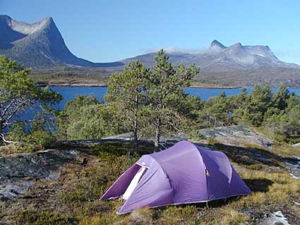
It's midnight as I set myself down at the kitchen table to reflect over my climbing experiences here in northern Scandinavia over the last couple of years. Despite the late hour, I can look out of the 10th floor window of my flat here in Kiruna, 200 km north of the Arctic Circle in Sweden, and it's full daylight outside, 2 weeks after the longest day (up here the longest day actually lasts for about a month and a half). In fine weather I can see Sweden's highest peak, Kebnekaise (certainly no giant at 2117 m), on the western horizon, some 30 km away, but it is really the proximity to northern Norway which makes Kiruna such a good base for a climber. The winter is long (the snow settles in October, and melts away at last at the end of May, making for a long ice climbing season), and there are plenty of good frozen waterfalls from one to seven pitches high within three hour's drive. The summer is correspondingly short, of course, but the midnight sun helps make up for it. It's light enough to climb right through the night for much longer than the month and a half that has actual midnight sun, so it's the weather rather than the threat of nightfall which may force a retreat from alpine rock routes. And northern Norway has a multitude of fine granite peaks within striking distance of Kiruna, with everything from short sport climbs to big walls of twenty pitches or more. Memories from last summer: sitting on a rounded rock slab in the evening sunlight with Ursila, looking out over the gently riffled waters of Efjord at the grey granite peaks of Kuglhornet (979 m), Sildpolltind (879 m) and Eidetind (845 m). Efjord is 80 km south of Narvik and only 250 km from Kiruna. The next fjord south of it is Tysfjord, and near the head of Tysfjord stands one of those rock features which, like Devil's Tower and Half Dome, could have been designed by a climber. Stetind is a great grey granite obelisk, flat on top as though hammered into place, and smooth on every side. It rises straight from the edge of the fjord up to its chiselled summit at 1392 metres. Maybe the track up beside a stream through the birch forest for the first hour and a half was different, but the rest of the climb reminded me a lot of routes in the Darrans. Stetind has a rounded shoulder like Sheerdown, and the Southeast Ridge which we climbed was very similar to the West Ridge of Sabre. Most of the route up to Hall's Peak (the low peak, at 1312 m) was straightforward, with just a bit of scrambling. Not long after leaving the mammoth cairn on Hall's Peak we roped up (for Ussi's sake) to follow a narrow and exposed ridge (like a grown-up version of Homer Ridge) down to the col, and then up towards the main summit. The crux came shortly after the col a short diagonal hand traverse along a flake, with good handholds but not much for the feet for several metres. There were rusty fixed pegs (dating back for all I know to the first ascent in 1910 an impressive climb for the time), and a good belay in a hole in the ridge at the top. With the "Mysosten" pitch (as it is known) behind us, it was mostly scrambling to the summit, which proved to be a flat area half the size of a football field, covered with boulders (and quite a bit of snow at the start of July). Of the lake with goldfish in it that Ussi had been told of by her climbing mentors in the Umeå Climbing Club in the mid-70's there was no sign at all. We made our way to another massive summit cairn (a Norwegian tradition, obviously) on the edge overlooking the fjord. It was a very similar feeling looking down on Ussi's little red car in the car park to that of looking down on the Milford Hotel from the top of Sheerdown. The descent was back along the ridge, with a 15 m abseil off the top of the block that forms "Mysosten". A dark shower circled to the north of us, with twin strips of rainbow over the green waters of Lake Koppvatnet far below, but the most we got was a chill breeze and a very few spits of rain from a single overhead cloud after the sun had come back out on the way back down the summit ridge. It started raining at about 8.30 p.m., but by then we were down off the peak, and were just above the climbers' campsite (with a Darrans bivy rock or two) under the South Face. And it only rained for half an hour or so anyway By the time we reached the car our knees were screaming after nearly 1400 m up and 1400 m down again in 12 and a half hours, but Stetind has long been an ambition of mine (I've had a postcard of it on my wall for years) and of Ussi's, so it was great to climb it together. We camped the night in the heath amongst scattered low pines overlooking Efjord with the sail-shaped peak of Kuglhornet and its knife-edged East Ridge bearing down on us. The next day was a well-earned rest day, with a swim in the fjord until the March flies drove us away, back over the bridges over Efjord. I checked out the hidden North Face of Eidetind for future reference and later found out that there is a classic new route of about 15 pitches called "Blodröd september natt" (Blood Red September Night) up the crack systems I had spied out. Later from the base of "Verdens sva" (The World Slab), which sweeps down like a long grey ski-field from Kuglhornet, I glassed the latter's North Face until distracted into watching a rough-legged buzzard and a small falcon wheeling high overhead. It wouldn't be a good place to be in the winter; a big avo must have come roaring down the slab like a super highway there was all sorts of broken timber (mostly birch trees, but also a few uprooted pine saplings) and quite a few rocks and boulders strewn about in the pine forest out to one side of where the climbers normally camp, just where there's a bend in the stream at the foot of the slab. When we woke next day to low cloud which hid all of Kuglhornet, we decided to do as we had done when we were last here (in 1982!) and packed up and caught the ferry out to the islands of Lofoten "The Magic Islands", as Ed Webster's guidebook calls them. We met up with Martin Morell, a friend from Kiruna, at our campsite on the beach at Kallestranda, and decided to climb one of Lofoten's absolute classics Svolvaergeita (The Svolvaer Goat). I hadn't really thought much about doing it before, but it's such a classic that it seemed to be a good thing to start with this time, especially since Martin was keen on it, and it was something all three of us could do. Svolvaergeita is a 100 metre-high granite pinnacle, perched high on the hillside above Svolvaer, Lofoten's largest town (and directly above its cemetery). The last 10 metres consist of twin blocks with a gap between them, forming the horns which give the "goat" its name. The route we chose was that of the original first ascent, by modern standards quite moderate, but an impressive effort for the time. It was climbed in 1910 by the same party which had shortly before made the first ascent of Stetind. In about 1930 the famous Norwegian climber Arne Randers Heen upped the ante a little by pioneering the now de rigueur leap between the horns, as the perfect finale to an ascent of Svolvaergeita. As the leader of the final pitch, I stood alone on the top of the highest horn, feeling like a kayaker about to commit to a difficult rapid, before gingerly making the one and a half metre leap across to the scalloped top of the slightly lower Lillehorn and the belay. Martin followed, posed for a photograph, and then with all the calm of the extreme skier that he is, hopped across to join me. Ussi was very nervous, and contented herself with climbing to the top of Lillehorn, but she was buzzing afterwards. With that behind us, Martin and I were ready for a longer route. We set up camp at the mouth of Djupfjord, and racked up for the West Buttress of Presten (The Priest). The next morning we got up at 6 a.m. and drove the short distance round the coast to the route. Ussi accompanied us on the 10 minute walk to the base, and took some photos of Martin on the first pitch. We did the Direct Start, which adds an extra pitch to the total (12 in all), adds another pitch of grade 6- and another of grade 6 (grade 19 and 20 Australian), and straightens out the line. The weather was perfect, and the view superb over rocky islets and open sea, with the other islands of Lofoten stretching south into the haze in diminishing shades of blue and grey. The grade 6 pitch on the Direct Start was a tricky corner with widely-spaced tight finger-jams in an otherwise very narrow crack. Once we rejoined the normal route there was another grade 6 pitch, with tricky bridging in a corner. The classic leaning dihedral high on the route, however, another grade 6, wasn't too bad. From below the corner catches the eye immediately (and this summer, back in Lofoten for a few days, there always seemed to be a party just starting up it as we drove past), but the right wall is slab angle, which compensates for the very overhanging left wall. The last real climbing pitch was up an awkward ramp to a short but delicate traverse which led across a steep slab to the start of the final grass gully. At 6 o'clock in the evening we could unrope at the top, and begin the awkward 2 hour descent down lush slopes on the southern side of the ridege, to Festvåg where Ussi met us with the car. A couple of weeks later we were again in Northern Norway, back at Efjord. As you drive across to Narvik from Kiruna, the mountains steepen towards the Norwegian border, to finally plunge in precipices down into the deep fjord of Rombaksbotn. All the way down the coast from Narvik there are mountains, but as you emerge out of a tunnel into Efjord they become Sheerdown-like towers of granite -- Kuglhornet and Eidetind. The great granite slab of "Verdens sva" has been quite a hit with Swedish mountainbikers since it was written up in a Swedish outdoors magazine, and at the foot of the slab is one of those magical campsites which keep us coming back though the years may intervene. It was here we met up with Martin for the next major climb of the summer. Like the West Buttress of Presten, our climb was to be a classic the ten-pitch South Buttress of Stetind. An early start from our campsite under Verdens Sva led via the new road, complete with long tunnels through a number of granite ridges, to the carpark at the foot of Stetind. It was Martin's first time here, so his desire to see what was round each new bend in the track led us up the hill at a cracking pace, and we could soon stash our packs under a block where the approach march left the descent route. We found the cairned track which led up and over to the talus field below the South Face ã there were one or two exposed moves, but mostly it was OK (like a Darrans "bicycle ledge"). From the talus field a ledge system leads in to the mid-point of the buttress; another delicate section of slab with gravel and slime got us up onto it, and then it was straightforward along to the big ledge of "Kongens losjen" (The King's Lodgings). It was an imposing place. The concave South Face looms above the talus field, which in its turn drops away over a rounded edge onto slabs and on down to the climbers' camp beneath. And the ledge system cuts across an extension of the face, which is much longer on the left, right round to the sharp edge of the West Ridge. The classic version of the South Buttress starts from this ledge, but there are just as many pitches again on the lower half all of which, as on Yosemite's Leaning Tower, provides plenty of exposure right from pitch 1. The weather when we woke up was fine, but there were wisps of cirrus cloud which thickened as we walked up the track. A halo formed round the sun, and the wind got up not too promising, but not bad enough yet to call the climb off. We had contemplated doing a more sustained climb called Gullfisken (Gold Fish), which starts from further along the ledge, but the next section of ledge after Kongens losjen looked quite tricky, especially in the gusty wind. We decided it would be wise to go for the closer and easier option in the prevailing weather conditions. So at 10.30 we roped up at the foot of Sydpillaren (the South Buttress). It was time to break out Martin's two new 60-metre 9 mm ropes, on a route where we could really benefit from the extra length. I led the first pitch, up some blocks and round into a grade 4 corner. With the rope drag caused by that manoeuvre I certainly didn't have a chance to stretch the pink and black lifelines out to their full length, but Martin got more out of them on the low-angled climbing of the second pitch, and I stretched them to their limit on the third with the result that I ended up in a hanging stance belayed off three wired stoppers at the base of a fine corner that Martin got to lead, up to (and in fact slightly beyond) the first "amfi" (a ledge system running the width of the South Face, and named for the circle in a theatre). When I got up to the ledge I realised that Martin was belayed in the corner the route didn't go up, so I put him back on belay while he climbed down and moved the anchors round the corner to the left. My pitch, the fifth, led up over a small roof and up a crack into a short chimney. I already had my polypropylene top and jersey on at the start of the climb, along with standard Kiwi climbing garb of shorts over long johns, but with the sun veiled by the gathering clouds and the wind strong and quite cold (blowing from the north), it was soon time to put on my windproof nylon parka. Martin had a polarfleece jacket, and a wool hat under his helmet, but with his calf-length climbing tights and lack of a windproof jacket he was getting quite cold. His next pitch, a short one, got us up to the second "amfi", which is an even more pronounced ledge system, allowing a retreat to the standard route just above the "Mysosten" block. Showers were threatening to come in from the south-west, and Martin sounded quite keen to traverse off, but the climbing above looked like the most worthwhile on the route (steeper, better quality rock and better lines after the fairly low-angled and broken ground below, which had rubble on the ledges and areas of rotten granite). Also I was keen to do the crux pitch, and to finish the route now that we were this close. The fairly skeletal topo we had seemed to suggest we were only two pitches from the top (although it looked further), so I talked Martin into going on. I led up a crack in the orange-brown wall to the crux corner as quickly and efficiently as I could. The crux moves under a little roof didn't feel like grade 6, even with cold hands, and I was able to run out the top section of the pitch to belay on a small ledge 55 metres above a cold-looking Martin. He dealt with the crux moves with no problems, and I thrust the gear sling at him for him to continue on up the crack and round to the left into a sloping corner. The wind was making communication difficult, so he mistook my call of "30 metres" for a warning to stop and belay, and I got the last pitch of real climbing, our 9th. It led on up the corner a short distance to the top of a block. I thought for one ghastly moment that it was a dead end, so to speak, but quickly found that a move down and across on the other side opened up a number of options. I chose the straightest, which pulled over a bulge (past an old piton possibly dating from Arne Naess and Nils Faarlund's 1966 first ascent) and onto a lichenous ledge. Martin traversed the ledge to a gully, then climbed the lichen-green wall beyond on an easy ramp which led to the broad boulder-strewn top of Stetind. The time was 6.50 p.m., and the climb had taken us just under 8 and a half hours. While
I coiled the ropes and re-racked the gear, Martin recorded
our ascent in the summit log before we started the descent
back down the east ridge and over the low peak. Ussi was
waiting for us in the shelter of the block where we had
stashed our gear, and together we wandered back down the
track through the birch forest. (Published in New Zealand Alpine Journal 1999) |
|
|
|